


2GIS beta

 |
Latest Version | 6.44.1.559.3 |
 |
Update | Apr,27/2025 |
 |
Developer | 2gis |
 |
OS | Android 6.0+ |
 |
Category | Maps & Navigation |
 |
Size | 179.3 MB |
 |
Google PlayStore |  |
| Tags: | Maps & Navigation |
-
Latest Version
6.44.1.559.3
-
Update
Apr,27/2025
-
Developer
2gis
-
OS
Android 6.0+
-
Category
Maps & Navigation
-
Size
179.3 MB
-
Google PlayStore


 Download(6.44.1.559.3)
City routes, live traffic, transit routes, parking, offline map, and navigation.
We're excited to announce that we've updated 2GIS! The current version of the app struggled to showcase the wealth of information we have about cities and businesses. In the new 2GIS, we've revamped the design, enhanced the search functionality, improved city updates, and integrated favorites with 2gis.ru.
Services, Addresses, and Companies
2GIS is your go-to source for finding out which service providers operate in your building, locating your nearest district hospital or post office, and choosing cafes or service centers based on reviews and photos. We provide opening hours and contact numbers to make your search even easier.
Transport and Navigation
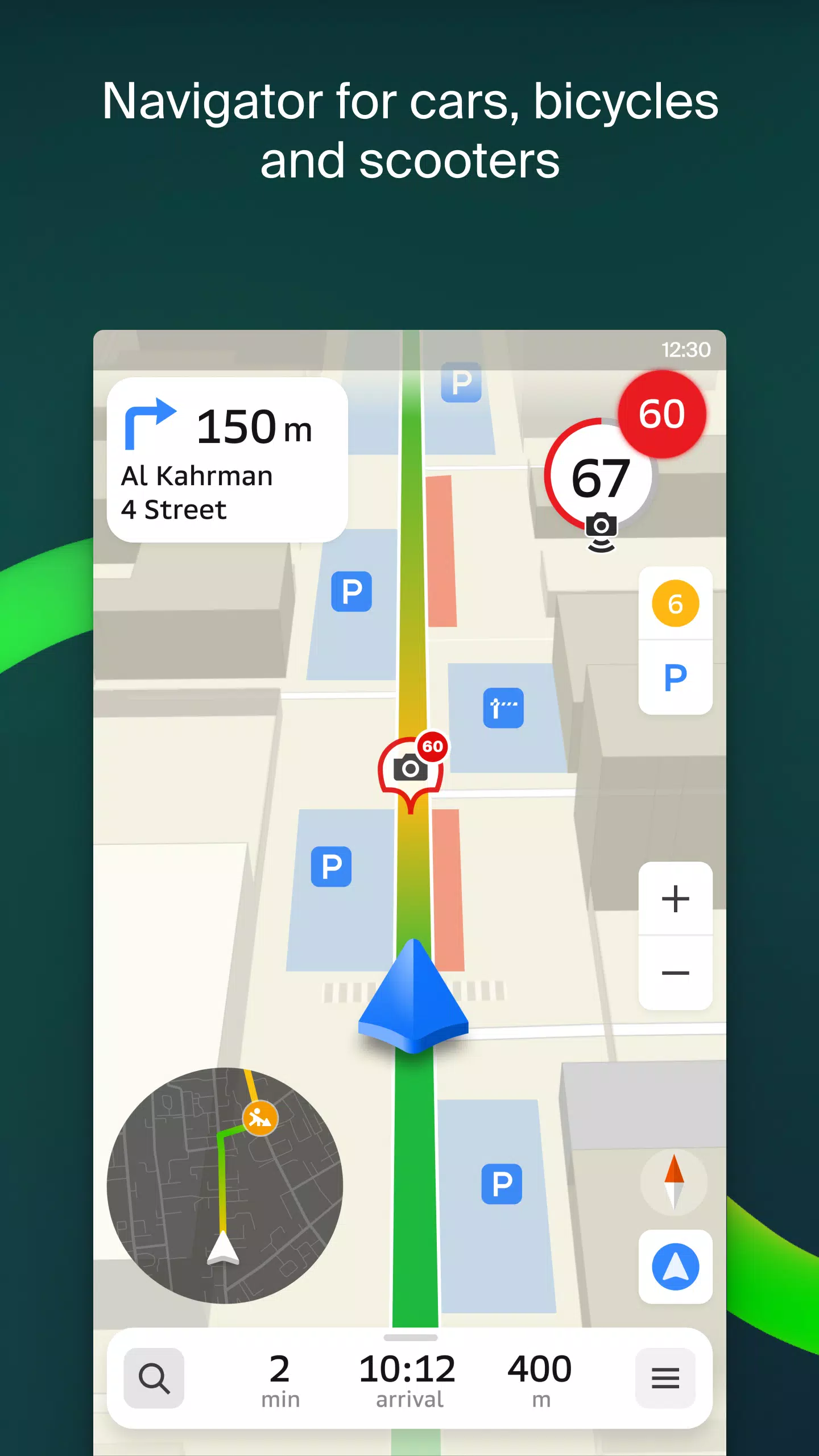
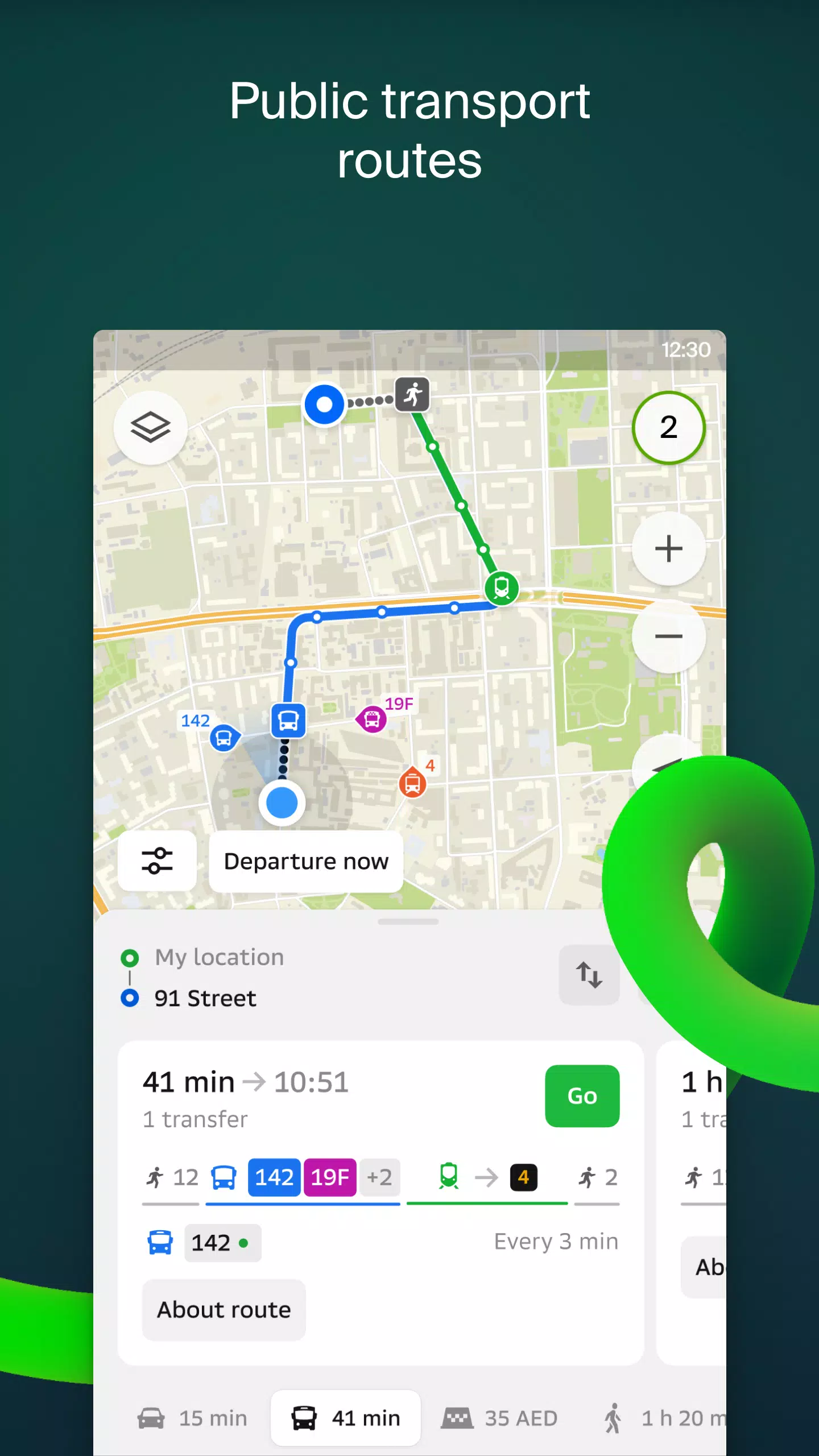
For drivers, 2GIS offers real-time navigation with voice instructions, taking into account traffic jams and roadblocks. If you stray from your planned route, we'll recalculate it on the fly. For pedestrians, we provide multiple options for traveling by bus, metro, train, cable car, and river tram.
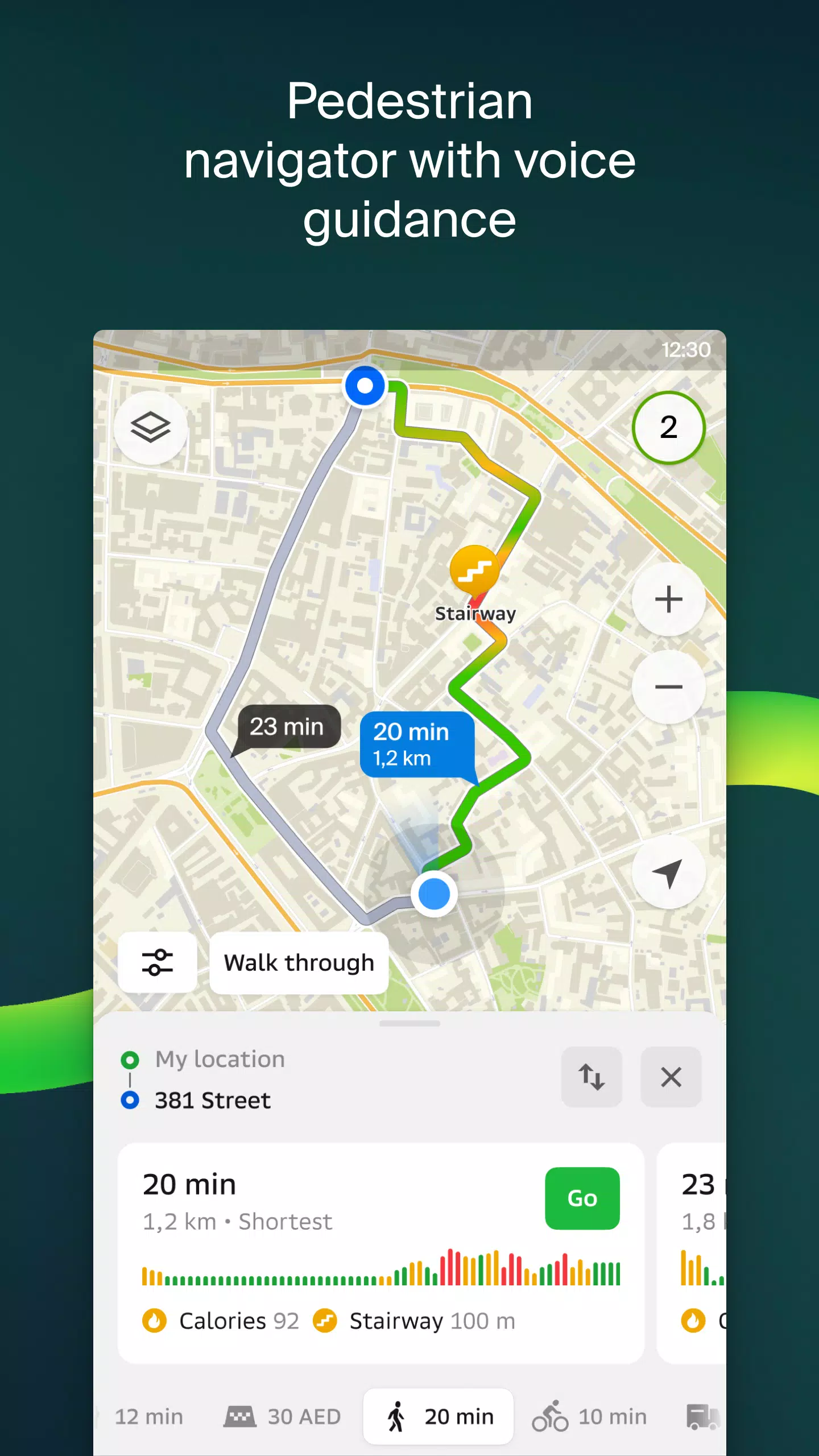
Walking Routes
Our pedestrian navigation feature guides you wherever you can walk, offering background operation and voice guidance for a seamless experience.
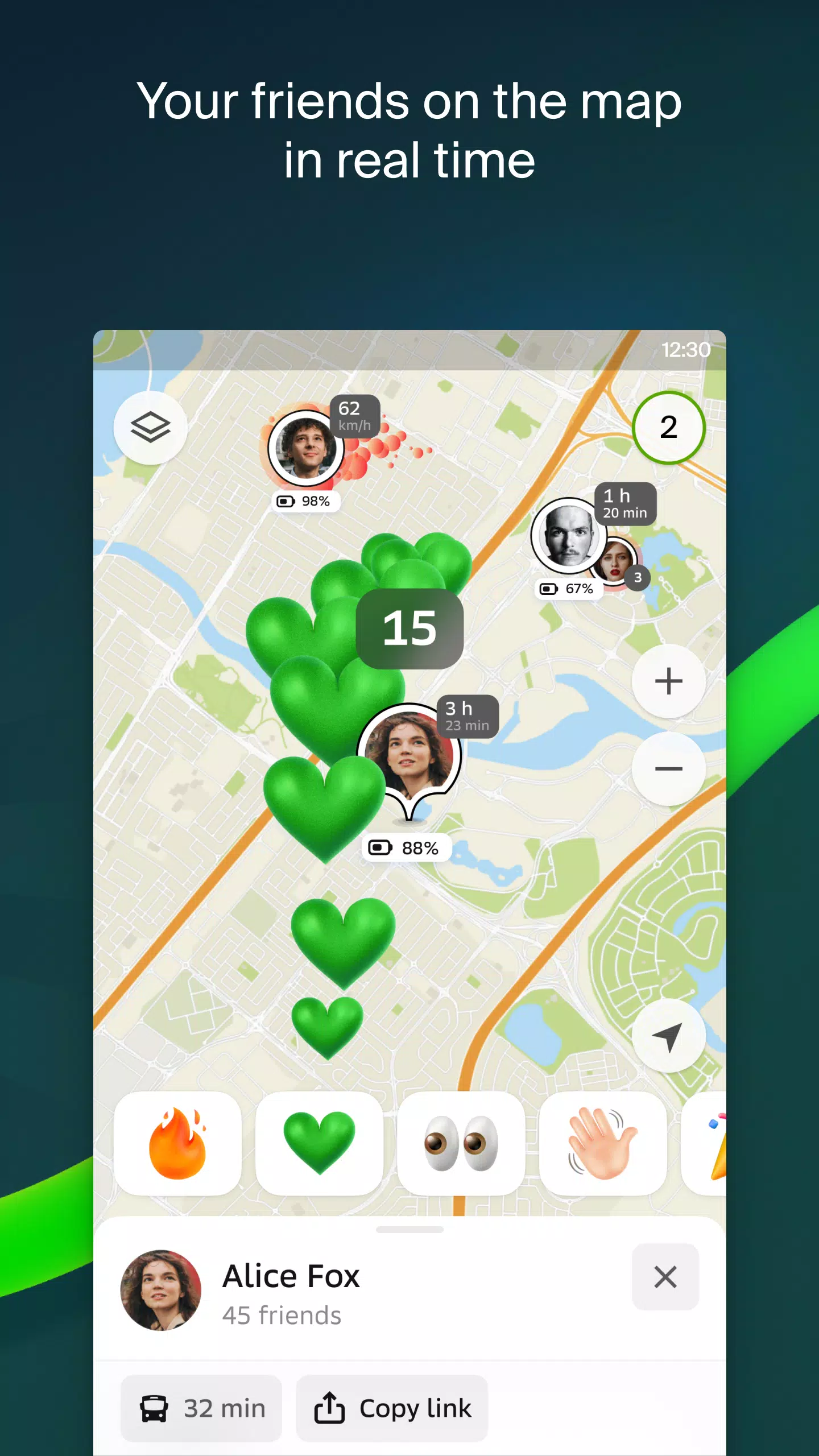
Friends on the Map
With 2GIS, you can now track your friends and children in real-time on the map. You control who you add as friends and who can see your location, with customizable visibility settings.
Building Entrances
No more wandering around to find the entrance to a business center. 2GIS provides access information for over 2.5 million companies. Whether you're driving or using public transport, we'll guide you right to the door.
Plans of Shopping Centers
Navigate shopping centers with ease using 2GIS. We show the location of shops, cafes, ATMs, and restrooms, helping you plan your visit efficiently.
2GIS Beta Notifications Companion App for Smart Watches
We've introduced a beta companion app for smart watches on Wear OS. This handy tool enhances navigation for walking, cycling, or using public transport directly from the main 2GIS beta app. View maps, get maneuver hints, and receive vibration alerts when approaching a turn or destination bus stop. The companion app starts automatically when you begin navigation on your phone and is compatible with Wear OS 3.0 and later.
As a beta tester, you'll receive the latest updates as we fix bugs and errors, contributing to the development of the new 2GIS version that millions will use. You don't need to delete the original app; the beta version runs simultaneously, allowing you to switch between them at any time.
Support: [email protected]
What's New in the Latest Version 6.44.1.559.3
Last updated on Oct 19, 2024
We're thrilled to bring you these crisp, beautiful updates:
- Enhanced road visuals on the main map and during route searches for a more realistic experience.
- Introducing Chats for Friends! Now you can message each other directly on the map.
- New nearby friend notifications, which you can toggle in settings.
- Just in time for ski season, we've added ski lift status updates on slopes.
- For public transport routes involving walking, we now calculate the walking portion in steps.