


2GIS: Offline map & navigation

 |
Latest Version | 6.44.1.559.3 |
 |
Update | Apr,29/2026 |
 |
Developer | 2gis |
 |
OS | Android 6.0+ |
 |
Category | Maps & Navigation |
 |
Size | 180.4 MB |
 |
Google PlayStore |  |
| Tags: | Maps & Navigation |
-
Latest Version
6.44.1.559.3
-
Update
Apr,29/2026
-
Developer
2gis
-
OS
Android 6.0+
-
Category
Maps & Navigation
-
Size
180.4 MB
-
Google PlayStore


 Download(6.44.1.559.3)
Offline maps with GPS navigation, real-time traffic updates, parking availability, public transit routes, and more essential features
2GIS offers comprehensive digital maps with GPS navigation for drivers and pedestrians, live traffic data, transit schedules, and an extensive city directory. Use it online or download maps for offline access to navigate seamlessly without internet connectivity.
With 2GIS's advanced mapping and navigation tools, you'll navigate unfamiliar locations with confidence:
— Quickly locate addresses, businesses, contact details, operating hours, and available products or services
— Plan routes for driving, public transportation, or walking with turn-by-turn navigation
— Identify building entrances and nearby parking facilities
Precision mapping. Locate neighborhoods, streets, buildings, transit stops, metro stations, fuel stations, recreational areas, and other points of interest.
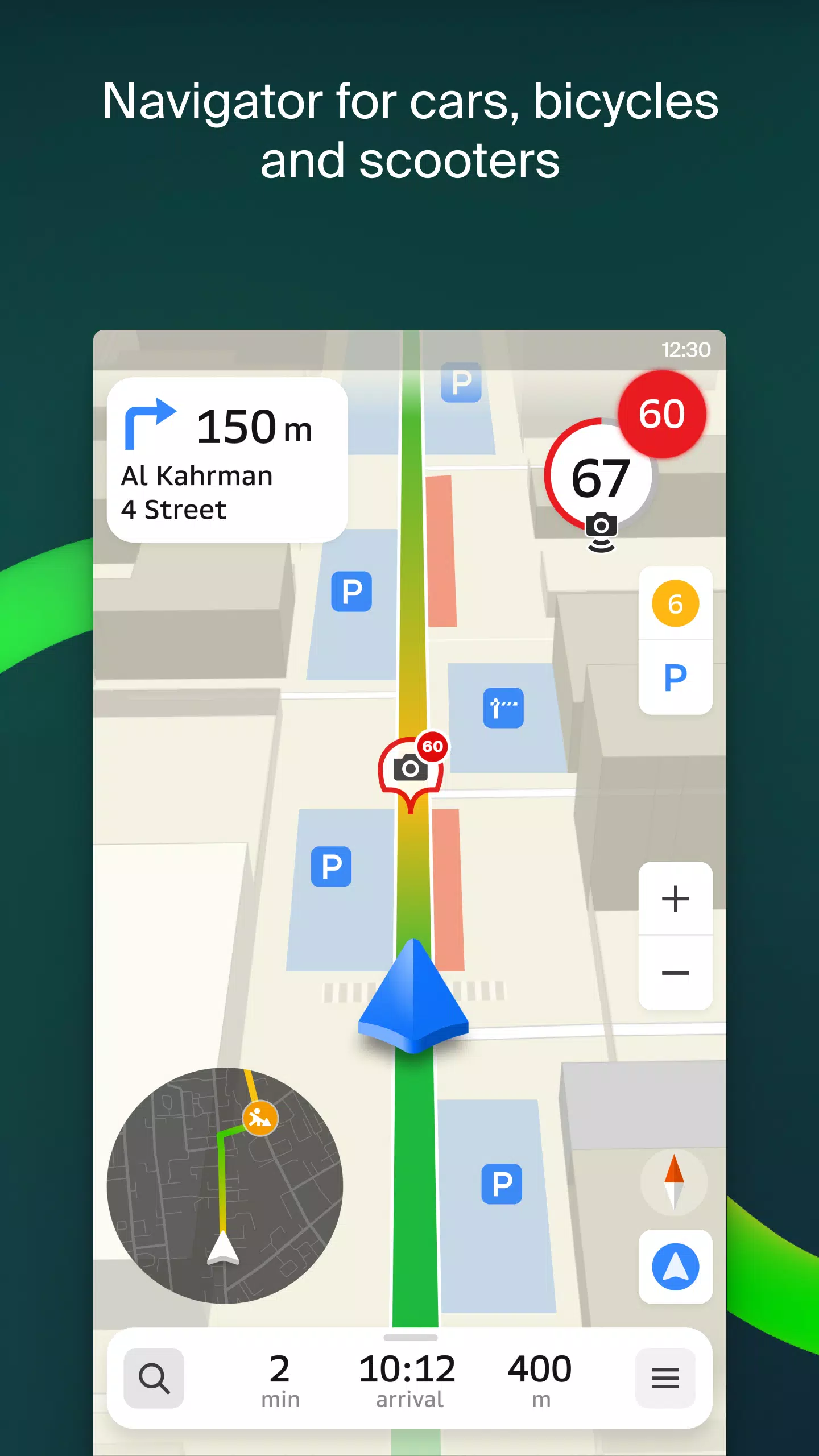
Advanced GPS navigation. Accounts for live traffic conditions, road signs, speed cameras, toll roads, and gravel routes. Creates multi-point itineraries including intercity travel. Compatible with Android Auto.
Real-time friend tracking. Monitor family members or friends on the map for safety with GPS location sharing. Exchange fun stickers and view battery status. Complete control over friend lists and location-sharing preferences with customizable privacy settings.
Road incident reports. Stay informed about accidents, road closures, speed cameras, and user-submitted updates directly on your map interface.
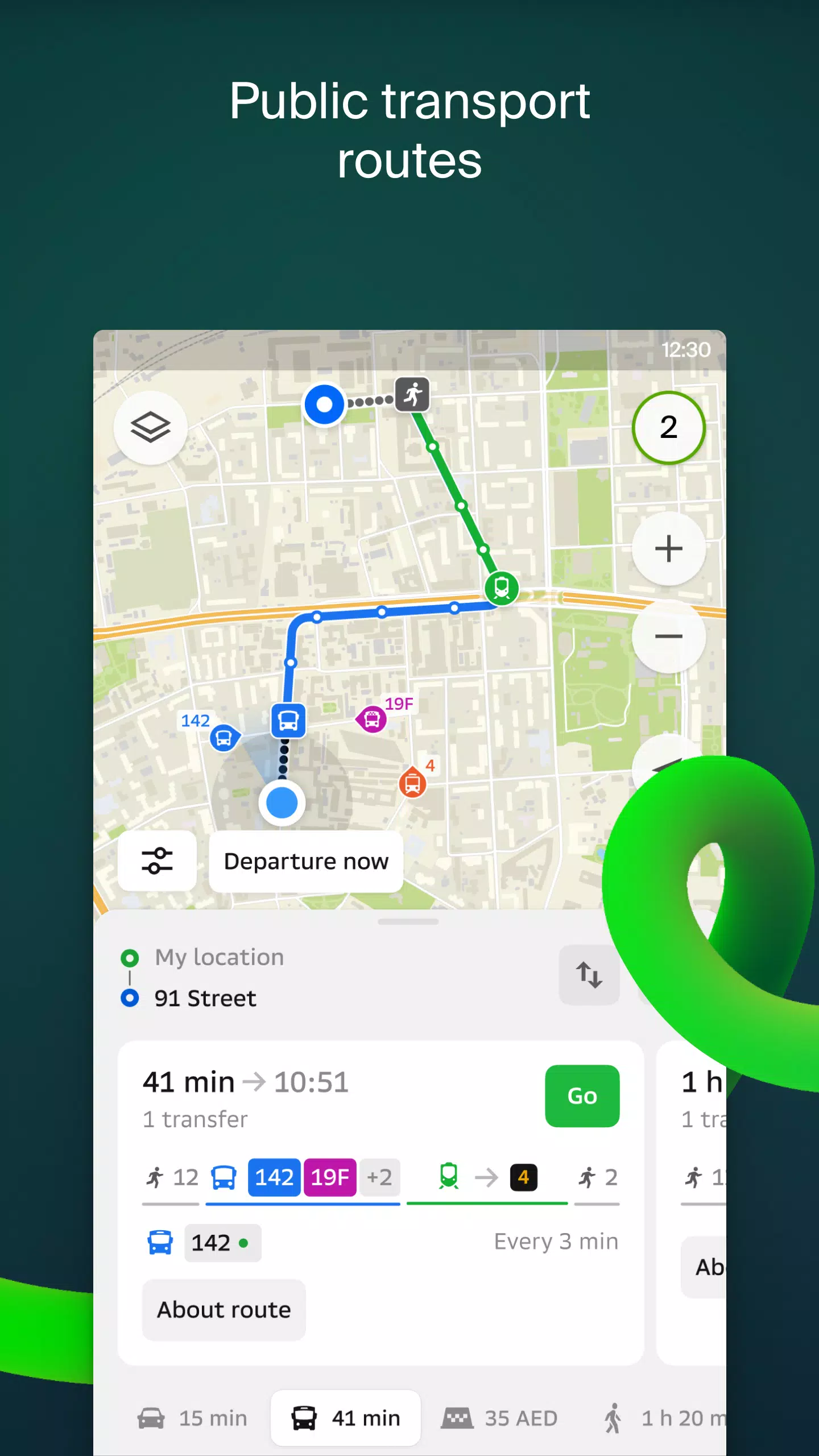
Public transportation. Access accurate schedules and optimized routes for buses, metro, and other transit options.
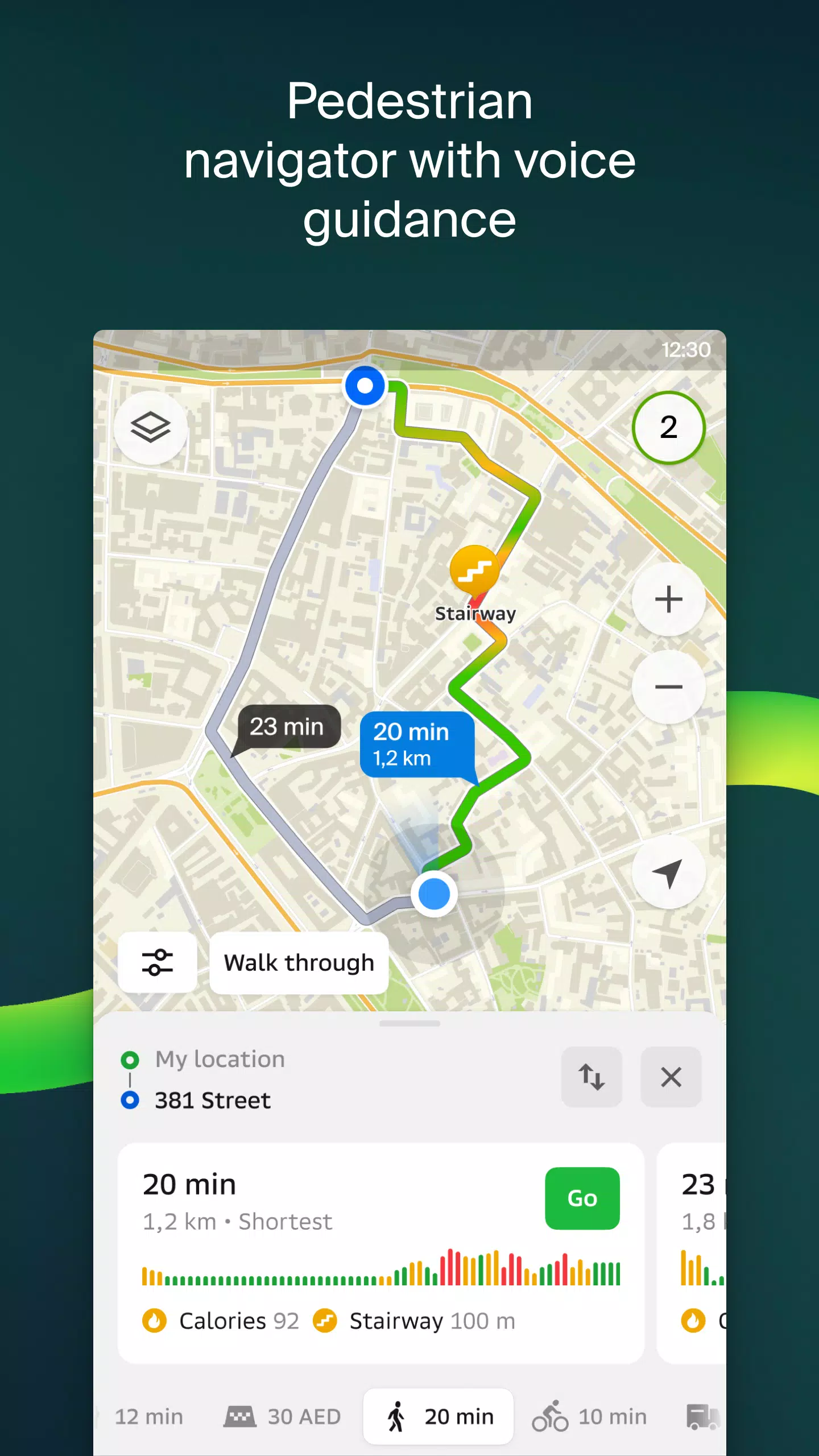
Pedestrian navigation. Detailed walking directions with voice guidance and background operation capability.
Commercial vehicle routing. Specialized navigation for trucks that considers vehicle specifications and cargo requirements.
Comprehensive business directory. Includes addresses, entrances, postal codes, contact information, operating hours, social media links, websites, and photos with user reviews.
Travel information. Discover notable attractions, WiFi hotspots, and other useful locations marked on the map.
Wear OS companion app. Extend navigation functionality to smartwatches with vibration alerts, maneuver prompts, and automatic synchronization when routing from your smartphone. Requires Wear OS 3.0 or newer.
Available coverage includes:
United Arab Emirates cities:
Dubai, Sharjah, Abu Dhabi, Al Ain, Ajman, Ras Al Khaimah, Fujairah, Umm Al Quwain, Dibba Al Fujairah, Khor Fakkan, Kalba, Al Salamh, etc.
Russian cities:
Moscow, Saint Petersburg, Novosibirsk, Yekaterinburg, Krasnoyarsk, Chelyabinsk, Ufa, Omsk, Kazan, Perm, Nizhny Novgorod, Sheregesh, etc.
Cities in Belarus, Kazakhstan, Uzbekistan, Azerbaijan, and Kyrgyzstan:
Minsk, Pavlodar, Semey, Aktau, Aktobe, Almaty, Nur-Sultan, Bishkek, Karaganda, Kokshetau, Kostanay, Osh, Baku, Tashkent, etc.
Support contact: [email protected]