


All-In-One Offline Maps

 |
Latest Version | 3.15d |
 |
Update | Apr,27/2025 |
 |
Developer | Psyberia |
 |
OS | Android 2.1+ |
 |
Category | Maps & Navigation |
 |
Size | 7.2 MB |
 |
Google PlayStore |  |
| Tags: | Maps & Navigation |
-
Latest Version
3.15d
-
Update
Apr,27/2025
-
Developer
Psyberia
-
OS
Android 2.1+
-
Category
Maps & Navigation
-
Size
7.2 MB
-
Google PlayStore


 Download(3.15d)
Discover the freedom of navigation with OfflineMaps, where you can access an extensive collection of maps without the hassle of ads, data sharing, or monetization. Enjoy a seamless experience with **no advertisements**, **no data sharing & monetization**, **no analytics**, and **no third-party libraries**. Tired of waiting for maps to load? With All-In-One OfflineMaps, once a map is displayed, it's stored and remains accessible instantly, even without an internet connection.
- **Want more than just roads on your maps?** OfflineMaps has you covered with a variety of map types to meet your needs.
- **Traveling to areas with poor network coverage?** No worries—your maps will remain available.
- **Heading abroad?** Never feel lost again with OfflineMaps by your side.
- **Concerned about your data allowance?** OfflineMaps helps reduce your data usage significantly.
★★ Maps ★★
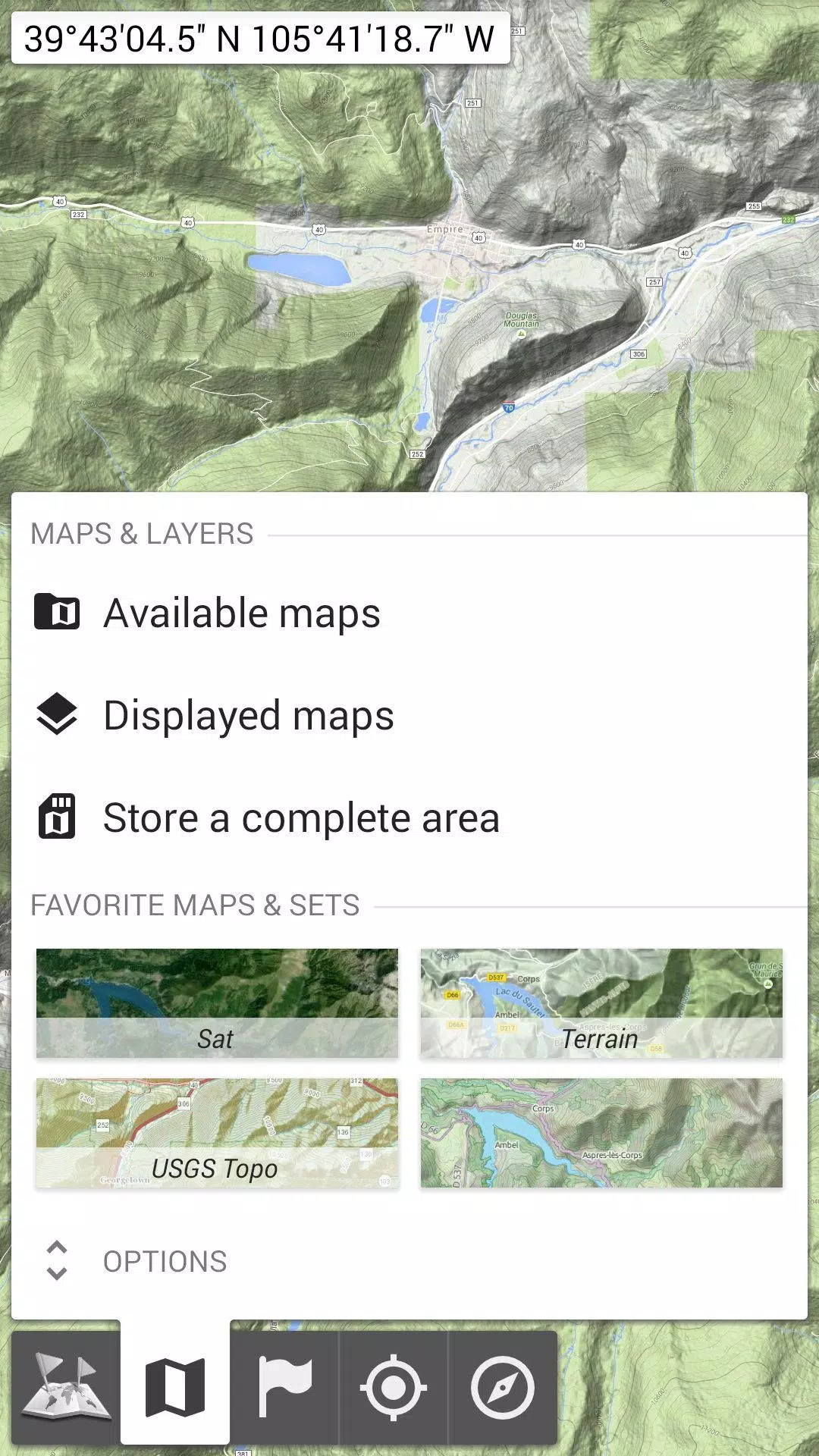
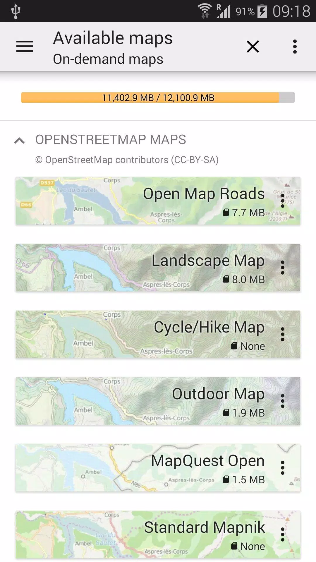
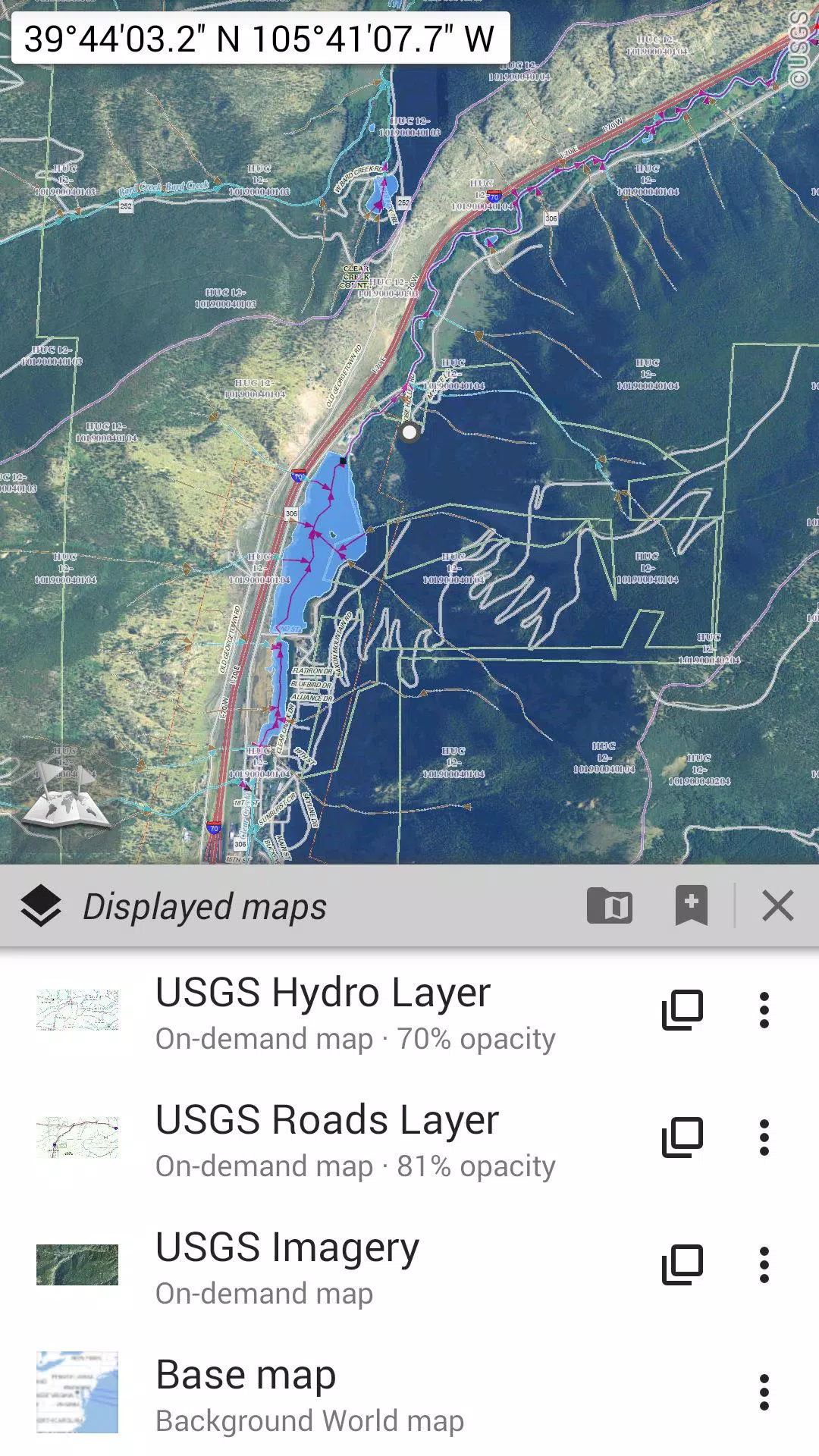
Explore a vast array of maps, from classic road maps to detailed topographic and aerial (satellite) maps. Add various layers such as OpenStreetMap (Roads, Topo), USGS National Map (Hi-res topo, Aerial imagery), and Worldwide Military Soviet topo maps. With OfflineMaps, you can:
- Layer multiple maps with precise opacity control for a customized view.
- Select and store large areas quickly and efficiently.
- Manage stored map data easily, with the option to delete as needed.
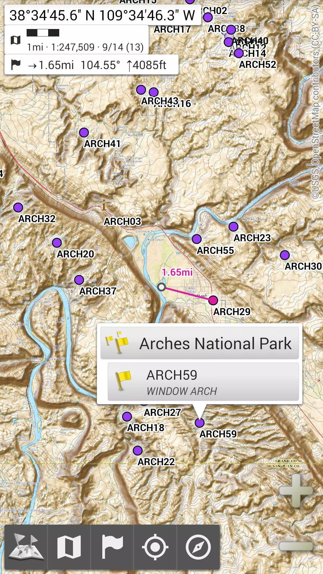
★★ Display, Store, and Retrieve Unlimited Placemarks ★★
Enhance your maps by adding waypoints, icons, routes, areas, and tracks. Manage these effortlessly with the powerful SD-Card Placemarks Explorer, ensuring you have all your important locations at your fingertips.
★★ On-map GPS Location & Orientation ★★
Navigate with confidence as OfflineMaps clearly displays your real-time location and direction on the map. The map can be rotated to align with your actual orientation, depending on your device's capabilities. Conserve battery life with easy on/off controls.
OfflineMaps also offers:
- Metric, imperial, and hybrid distance units for versatile use.
- Various GPS coordinate formats including Latitude/Longitude, UTM, MGRS, USNG, OSGB Grid, Irish Grid, Swiss Grid, Lambert Grids, DFCI Grid, and QTH Maidenhead Locator System.
- Import hundreds of coordinate formats from spatialreference.org.
- On-map grid displays for enhanced navigation.
- Full-screen map view for an immersive experience.
- Multi-touch zoom for easy map navigation.
- ...and much more!
★★ Need More? ★★
For the avid adventurer, take your exploration to the next level with **AlpineQuest Off-Road Explorer**. Built on the foundation of All-In-One OfflineMaps, it offers a comprehensive outdoor solution complete with a powerful GPS Track Recorder and more. Learn more at AlpineQuest.