


AlpineQuest Explorer Lite

 |
Latest Version | 2.3.8d |
 |
Update | Apr,23/2025 |
 |
Developer | Psyberia |
 |
OS | Android 2.1+ |
 |
Category | Travel & Local |
 |
Size | 8.0 MB |
 |
Google PlayStore |  |
| Tags: | Travel & Local |
-
Latest Version
2.3.8d
-
Update
Apr,23/2025
-
Developer
Psyberia
-
OS
Android 2.1+
-
Category
Travel & Local
-
Size
8.0 MB
-
Google PlayStore


 Download(2.3.8d)
Transform your smartphone into a robust off-road GPS with AlpineQuest, utilizing offline topographic maps for a seamless experience.
No advertisements ~ No data sharing & monetization ~ No analytics ~ No third party libraries
AlpineQuest stands as the ultimate tool for all your outdoor activities and sports, from hiking and running to trailing, hunting, sailing, geocaching, and off-road navigation.
With access to a vast array of online topographic maps that can be stored locally, you'll stay navigated even without cell coverage. The app also supports numerous on-board file-based raster map formats.
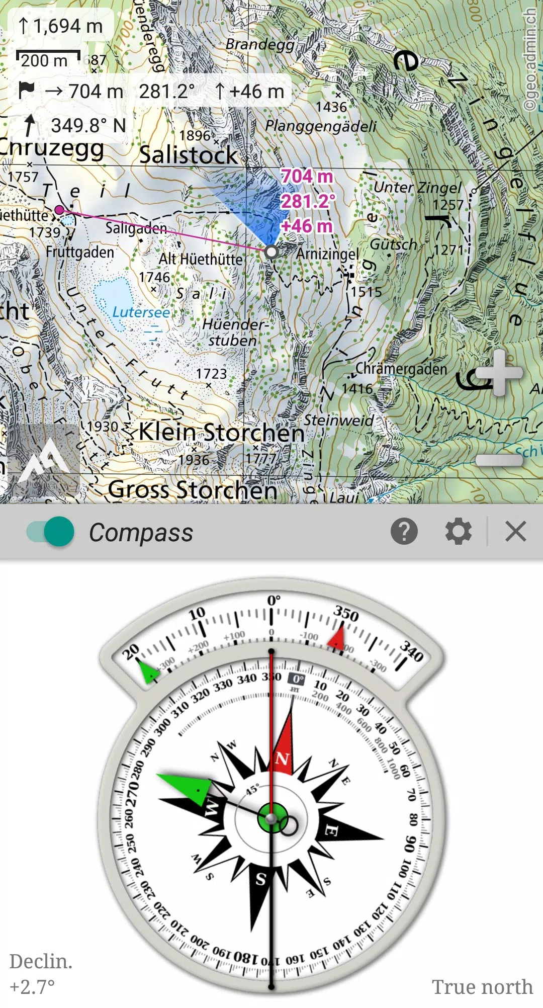
Leveraging your device's GPS and magnetic sensor, complete with a compass display, real-time location tracking on the map ensures you'll never lose your way. The map can also orient itself to align with your current view.
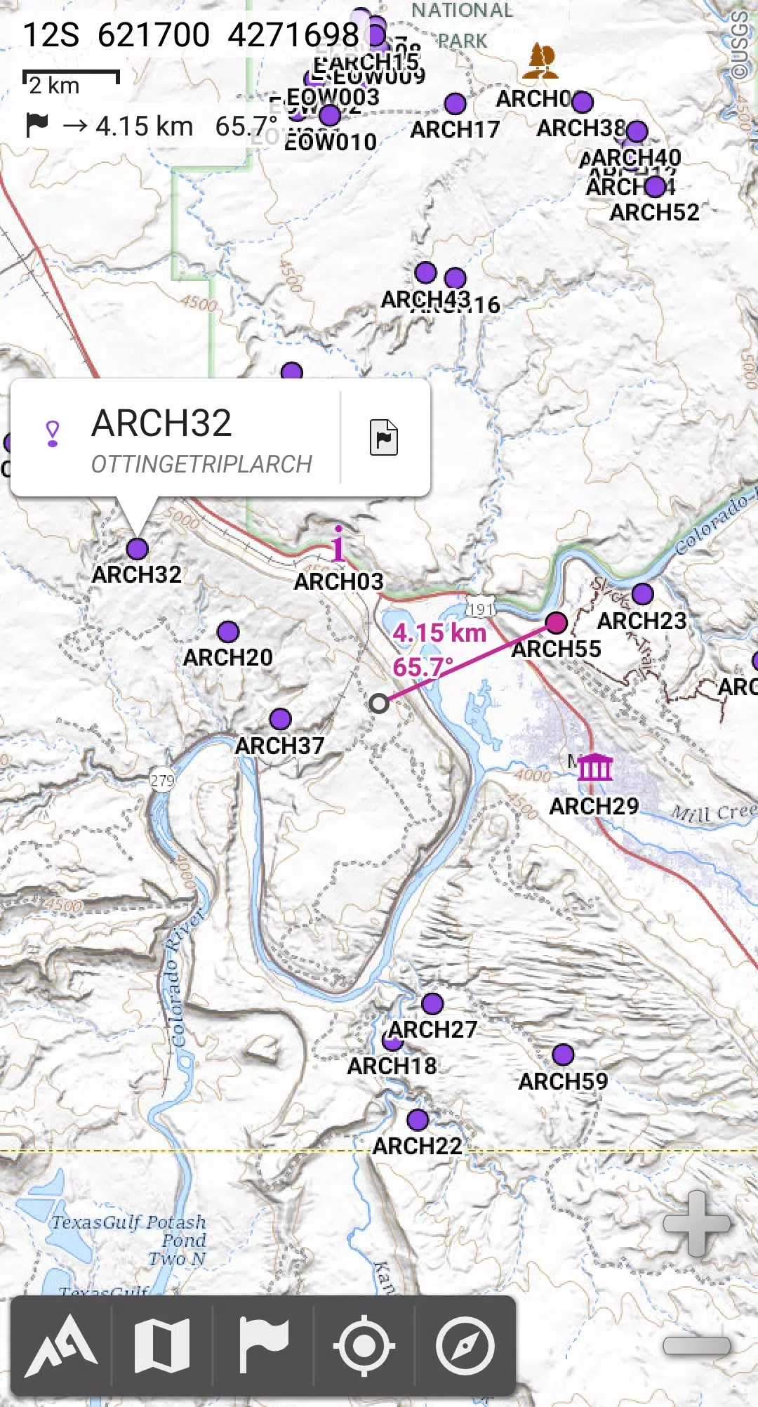
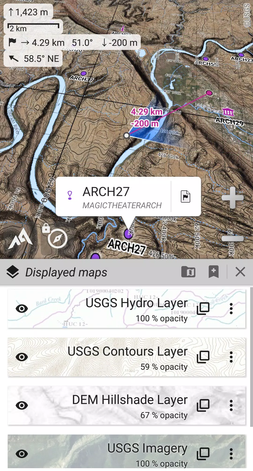
Effortlessly save, retrieve, and share an unlimited number of placemarks with friends. Track your journeys, delve into advanced statistics, and explore interactive graphics to enhance your outdoor experience.
AlpineQuest remains fully functional beyond cell coverage, making it the perfect companion for your wilderness adventures.
Try the Lite version for free now and experience the difference!
For feedback or issues, please visit our dedicated forum at https://www.alpinequest.net/forum (no registration required, all questions answered) rather than leaving comments.
Key features (full version):
★★ Maps ★★
• Integrated online maps with automatic local storage (including road, topo, and satellite maps) and online layers (like road names, hillshade, and contours);
• Access more online maps and layers with a single click from our community maps list, covering major global and local topographic maps;
• Complete area storage for offline use of online maps;
• Support for on-board offline maps (raster), including KMZ Overlays, OziExplorer OZFx2, OZFx3 (partly), calibrated images, GeoTiff, GeoPackage GeoPkg, MbTile, SqliteDB, and TMS zipped tiles (visit our website for MOBAC, the free map creator);
• Compatibility with QuickChart Memory Map (.qct maps only, .qc3 not supported);
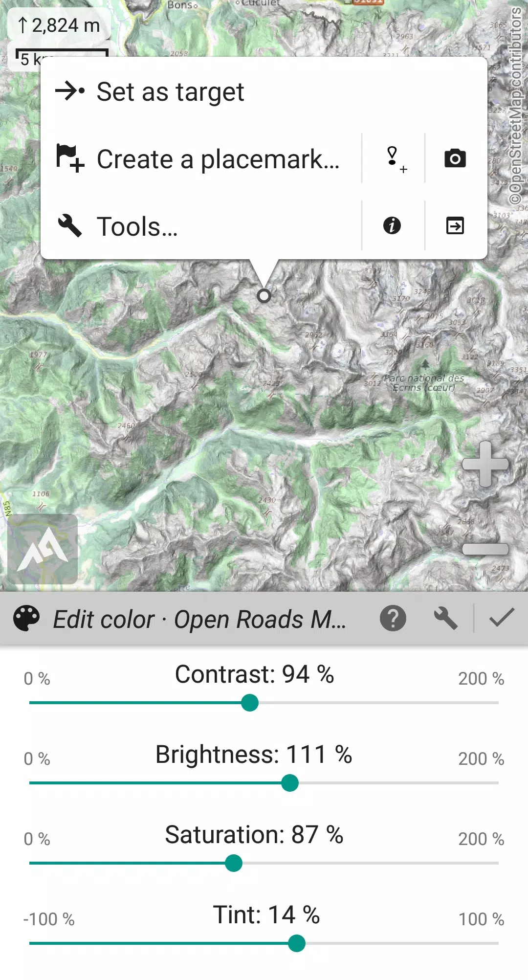
• Built-in image calibration tool for using any scan or picture as a map;
• On-board storage of digital elevation model (1-arcsec SRTM DEM) and support for HGT elevation files (1-arcsec and 3-arcsec resolutions) for displaying terrain, hillshade, and steep slopes;
• Support for polar maps (Arctic and Antarctic);
• Display multiple maps in layers with customizable opacity, contrast, color, tint, and blending controls.
★★ Placemarks ★★
• Create, display, save, and restore an unlimited number of items including waypoints, routes, areas, and tracks;
• Import and export GPX, Google Earth KML/KMZ, and CSV/TSV files;
• Import ShapeFile SHP/PRJ/DBF, OziExplorer WPT/PLT, GeoJSON, IGC tracks, Geocaching LOC waypoints and export AutoCAD DXF files;
• Save and share locations online with other users through Community Placemarks;
• Access details, advanced statistics, and interactive graphics for various items;
• Utilize the Time Controller to replay time-tagged tracks.
★★ GNSS Position / Orientation ★★
• On-map geolocation using your device’s GNSS receivers (GPS/Glonass/Galileo/…) or Network;
• Map orientation with compass and target finder;
• Integrated GNSS/Barometric track recorder (capable of long tracking in a separate, lightweight process) with battery level and network strength recording;
• Set up proximity and leave path alerts;
• Support for barometer on compatible devices.
★★ And more ★★
• Choose from metric, imperial, nautical, or hybrid distance units;
• Use latitude/longitude or grid coordinate formats (WGS, UTM, MGRS, USNG, OSGB, SK42, Lambert, QTH, …) with on-map grids display;
• Import numerous coordinate formats from https://www.spatialreference.org;
• …
What's New in Version 2.3.8d
Last updated on Aug 14, 2024
2.3.8b/c/d
• New setting to customize the display style and position of the menu bar;
• Enhanced compatibility with recent Android versions;
• Improved backup and restore functionality;
• Updated default URL for sharing coordinates as text;
• Option to set the application’s “Media” folder as the default for placemarks, icons, pictures, and file-based maps;
• Added Croatian and Persian language support;
• Various enhancements and bug fixes.
-
 OutdoorEnthusiastAlpineQuest has transformed my hiking experience. The offline maps are incredibly detailed and reliable. No ads and no data sharing make it a privacy-friendly choice. A must-have for any outdoor adventurer!
 -
WanderliebhaberAlpineQuest ist nützlich für Wanderungen, aber die App könnte schneller sein. Die Offline-Karten sind gut, aber die Benutzeroberfläche könnte benutzerfreundlicher sein. Trotzdem eine gute Wahl für Outdoor-Aktivitäten.
-
RandonneurPassionnéAlpineQuest est un outil incroyable pour les activités en plein air. Les cartes topographiques hors ligne sont précises et fiables. Pas de publicité ni de partage de données, c'est parfait pour la confidentialité.
-
AventureroMontañeroAlpineQuest es útil para senderismo, pero la interfaz podría ser más intuitiva. Los mapas sin conexión son buenos, pero a veces la aplicación se vuelve lenta. Es una buena opción, pero necesita mejoras.
-
户外爱好者AlpineQuest让我的徒步体验大大提升。离线地图非常详细且可靠,没有广告和数据共享,非常尊重隐私。每个户外探险者都应该拥有它!