


Just Draw It! - Route planner
 |
Latest Version | 4.1.7 |
 |
Update | Mar,14/2025 |
 |
Developer | Lapaca Devs |
 |
OS | Android 5.1 or later |
 |
Category | Lifestyle |
 |
Size | 14.70M |
| Tags: | Lifestyle |
-
Latest Version
4.1.7
-
Update
Mar,14/2025
-
Developer
Lapaca Devs
-
OS
Android 5.1 or later
-
Category
Lifestyle
-
Size
14.70M


 Download(4.1.7)
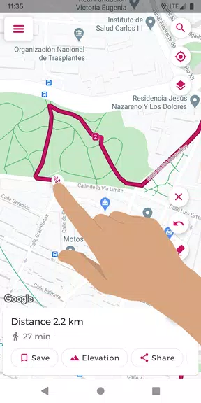
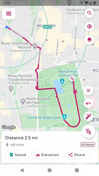
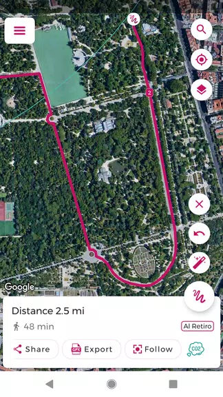
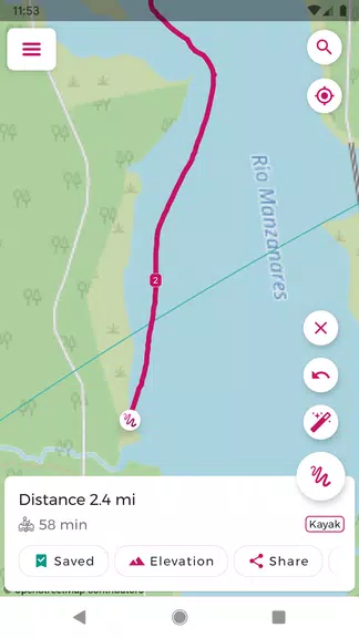
Effortlessly plan your route with Just Draw It! - Route planner. Simply trace your desired path on the map with your finger to instantly view the total distance. Whether you're jogging, walking, cycling, or engaging in any other outdoor activity, this app simplifies route planning, eliminating the guesswork. Save your favorite routes for easy access, import and export GPX files for seamless route sharing and editing, and even analyze elevation profiles for a comprehensive overview. Features like snap-to-road functionality and integrated places search make route creation incredibly intuitive. Say goodbye to getting lost and hello to confident exploration with Just Draw It! - Route planner.
Features of Just Draw It! - Route planner:
- Intuitive Finger-Drawn Routes: Plan your route by effortlessly tracing it on the map with your finger.
- GPX File Import/Export: Edit existing routes or share your creations with friends and fellow adventurers.
- Precise Distance Calculation: Obtain accurate distance measurements for your planned route.
- Favorite Route Saving: Save frequently used routes for quick and easy access.
- Snap-to-Road Functionality: Ensure accurate route planning by snapping your drawn path to existing roads and paths.
- Elevation Profile Visualization: View the elevation changes along your route to prepare for ascents and descents.
Tips for Users:
- Pre-Trip Planning: Utilize Just Draw It! to plan your route and calculate the distance before embarking on your activity.
- Efficient Route Editing: Save time by importing and modifying existing GPX files to suit your needs.
- Shared Adventures: Share your meticulously crafted routes with friends to explore new areas together.
- Precise Starting Points: Employ the places search feature to easily pinpoint your starting location.
- Elevation Awareness: Review the elevation profile to anticipate and prepare for any challenging inclines or declines.
Conclusion:
Just Draw It! - Route planner is the ideal companion for all your outdoor pursuits, from leisurely walks and invigorating runs to cycling excursions and boating adventures. Its user-friendly interface, coupled with precise distance calculations, makes route planning a breeze. Download now and confidently explore the world around you!
-
 Trailblazer123Just Draw It! makes route planning so easy and intuitive! I love how I can simply draw my path on the map and instantly see the distance. Perfect for runners and cyclists. The interface is clean, and it works smoothly even on older devices. Only 1 small issue—sometimes the auto-zoom doesn’t adjust perfectly. But overall, a 5-star app! 🏃♂️🚴♀️