


MAPinr - KML/KMZ/OFFLINE/GIS

 |
Latest Version | 4.1.2 |
 |
Update | Apr,23/2025 |
 |
Developer | Xylem Technologies |
 |
OS | Android 6.0+ |
 |
Category | Travel & Local |
 |
Size | 76.3 MB |
 |
Google PlayStore |  |
| Tags: | Travel & Local |
-
Latest Version
4.1.2
-
Update
Apr,23/2025
-
Developer
Xylem Technologies
-
OS
Android 6.0+
-
Category
Travel & Local
-
Size
76.3 MB
-
Google PlayStore


 Download(4.1.2)
Mapinr offers easy management of KML/KMZ/GPX files, GIS functions, measuring capabilities, GPS logging, WMS support, and offline maps. It's designed to streamline your experience with geographic data and mapping.
Thank you for choosing Mapinr. The rapid evolution of Android versions poses challenges for non-profit projects like ours. However, we remain committed to our mission of providing a secure, privacy-friendly, and affordable app. We understand that Google requires a minimum Android version that not all devices support. To accommodate this, we offer downloads for older Android versions (below Android 14) on our website, as they are no longer supported by the Play Store.
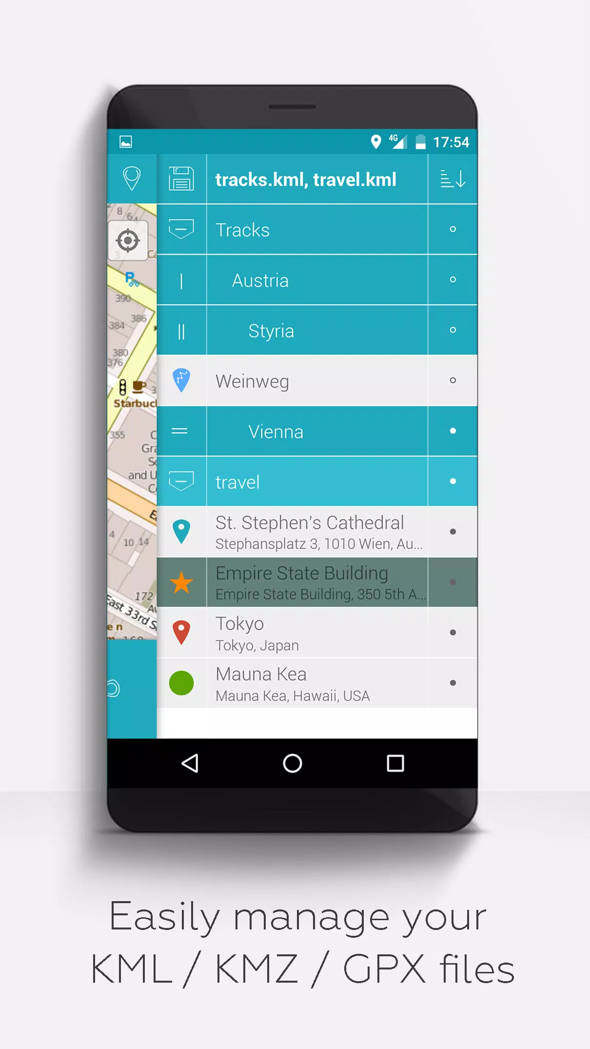
Do you need to manage your own points of interest or want to place your pictures on a map? MAPinr is the perfect solution. It's a straightforward, ad-free Android app that enables you to manage your KML/KMZ files and display your GPX files on various maps. MAPinr is ideal for professional use as well as activities like hiking, cycling, running, and skiing.
Please share your issues and suggestions for improving MAPinr by emailing us at [email protected]. We appreciate constructive feedback and understand that software bugs can be frustrating. Please be patient, as our limited resources mean we can't implement every suggestion immediately.
MAPinr offers the following features:
- Ad-free experience
- Hierarchical folder structure for managing multiple KML/KMZ/GPX files
- Create, load, edit, save, import, export, and share KML/KMZ files
- Create, load, edit, save, import, export, and share waypoints, lines/tracks, and polygons
- Add pictures to waypoints to create photomaps
- Display waypoints, lines/tracks, and polygons on various maps (Maps, Satellite, Hybrid, OpenStreetMap, Opentopomap, Opencyclemap)
- Share coordinates of waypoints
- Customize colors for waypoints, lines/tracks, and polygons
- Open exported KML/KMZ files in other apps
- Search by name, address, and coordinates
- Location-sharing to keep friends updated on your whereabouts
- Display multiple KML/KMZ/GPX files at the same time
- Merge KML/KMZ files
- Cloud integration
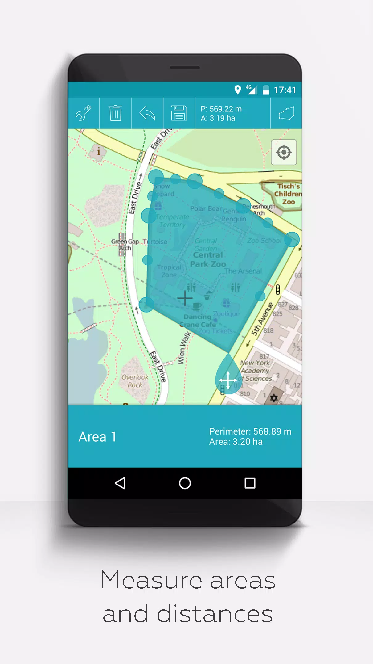
- Measure distances and areas on your map
- Multilingual support (currently English, Spanish, Lithuanian, Polish)
Extended features (available for free with donations or a LinkedIn like; activate in Settings):
- Download maps for offline use (OpenStreetMap)
- View GPX files
- Display arbitrary map data using Web Map Service (WMS), e.g., OpenData from www.data.gov
- Create custom metadata
- Upload and use custom icons
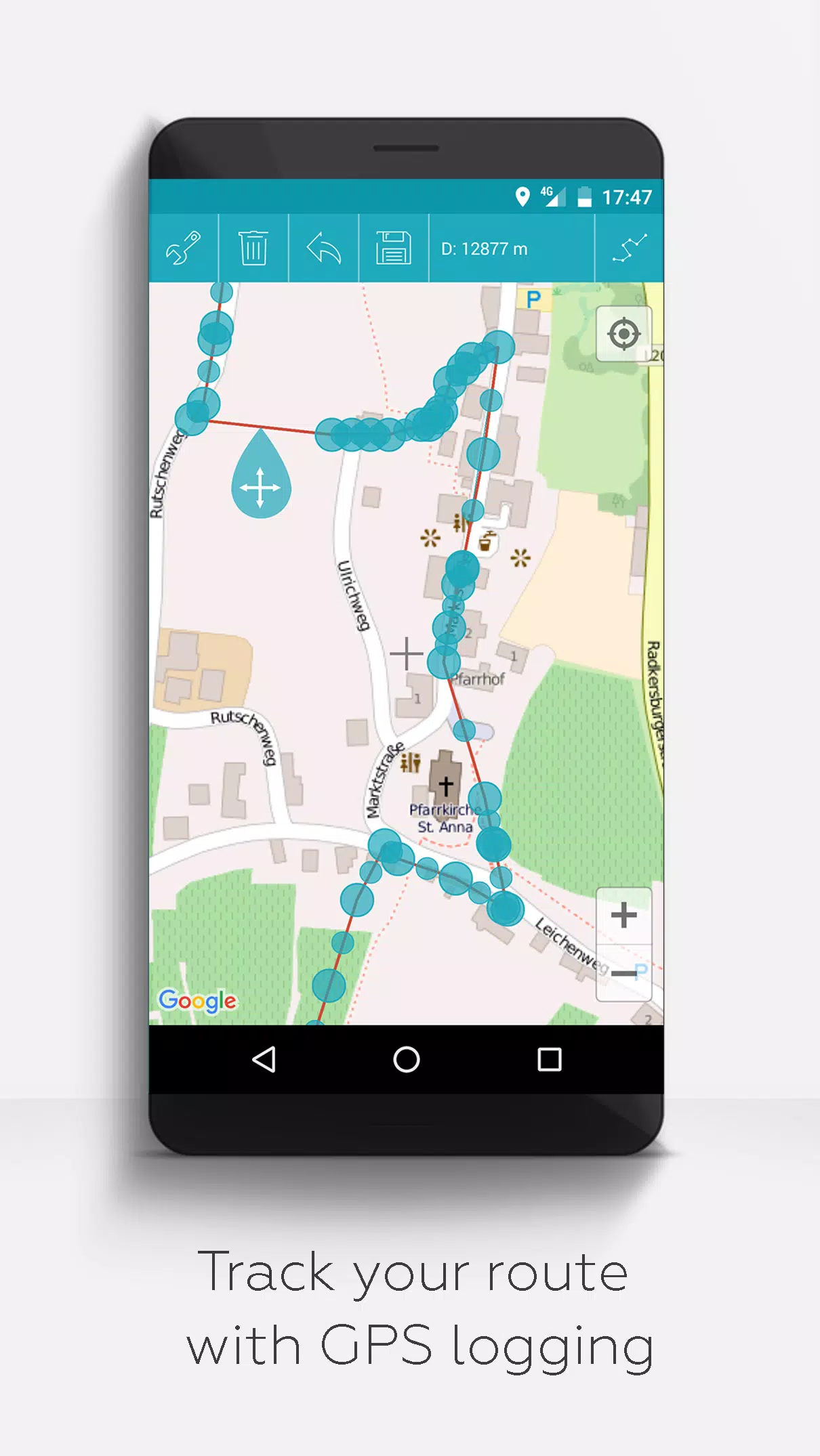
- Record GPS tracks
Compared to similar apps, MAPinr respects your privacy and does not collect or sell your data. Please note that donations are a voluntary contribution to support our non-profit efforts.