


Minecraft Gets a Free Map of Iconic Underground Tokyo Location, Thanks to Japanese Government
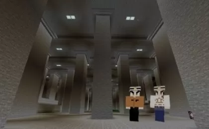
The Japanese government has unveiled a free Minecraft map that brings one of the world’s largest underground flood prevention facilities directly to your screen. This immersive experience allows players to explore the iconic G-Cans (Metropolitan Area Outer Underground Discharge Channel), a lesser-known yet awe-inspiring engineering marvel located in the Tokyo area, all from the comfort of home.
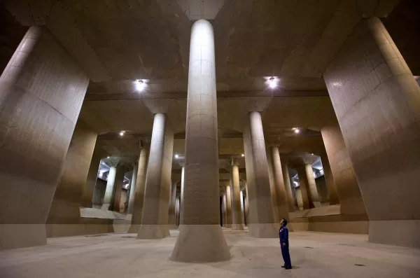
Officially known as the Metropolitan Area Outer Underground Discharge Channel and affectionately referred to as G-Cans, this facility plays a critical role in disaster prevention. Its most famous feature is the “pressure adjustment water tank” — an enormous cathedral-like chamber supported by 59 colossal pillars. Often dubbed the “underground temple” (chika shinden) in Japan, this dramatic space has even served as a filming location for music videos, TV dramas like Kamen Rider, and movies.
While it's possible to tour G-Cans in person during dry seasons, the Japanese Ministry of Land, Infrastructure, Transport and Tourism (MLIT) now offers a unique digital alternative through Minecraft. The ministry has also released a video on their official YouTube channel explaining G-Cans’ purpose and showcasing its representation in the game.
This Minecraft map isn't limited to just the underground structure — it includes a detailed overground environment featuring rivers, homes, and neighborhoods. These elements help illustrate how G-Cans functions to protect communities from flooding. Players can even step into the control room and simulate draining excess rainwater into the massive underground shafts to better understand how the system operates.
MLIT developed this Minecraft recreation with education in mind, aiming to raise awareness about the importance of flood prevention infrastructure. Exploring the blocky version of G-Cans still gives players a strong sense of its immense scale. In reality, the concrete tunnels stretch more than 6 kilometers beneath Saitama Prefecture as part of the Greater Tokyo Area. During Japan’s rainy season (typically June) and typhoon season (usually September), G-Cans captures overflow from vulnerable rivers and gradually releases it into the larger Edogawa River and eventually Tokyo Bay. Completed in 2006 after more than a decade of construction, G-Cans has been instrumental in reducing flood risks ever since.
The G-Cans Minecraft map is available as a free download from the official website of the Edogawa River Office, the agency responsible for managing the facility. To play, you'll need at least Version 1.21.1 of Minecraft Bedrock Edition or Version 1.21.0 of Minecraft Education Edition.
-
 Mar 17,25All Split Fiction Achievements & How to Unlock Them Dive into the captivating co-op adventure Split Fiction from Hazelight Studios! This guide outlines every achievement, ensuring you and your partner conquer every challenge. While some trophies are earned naturally through the story, many require thorough exploration and unique actions. Use this g
 -
 Apr 05,25Balatro Cheats: Accessing the Debug Menu Guide Balatro took the gaming world by storm upon its release in early 2024, selling over 3.5 million copies and clinching three out of five nominations at the 2024 Game Awards. Its innovative gameplay and endless replayability have kept it a favorite among players. As players become more adept at its mec
 -
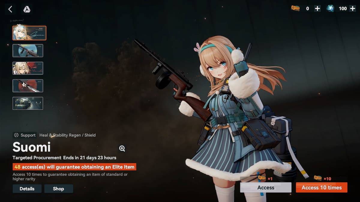 Jan 16,25Girls' Frontline 2: Exilium Tier List Released Another free-to-play gacha game, another character ranking to guide your investment choices. This Girls’ Frontline 2: Exilium character tier list helps you prioritize which characters are worth your resources. Girls’ Frontline 2: Exilium Character Tier List Here's a breakdown of currently available
 -
 Apr 09,25"Top 11 Minecraft Alternatives to Play in 2025" Minecraft has captivated gamers around the globe, becoming one of the best-selling games ever. But what if it's not quite your cup of tea? Or perhaps you're a die-hard fan looking for more experiences in the same genre? We've curated a list of the 11 best games similar to Minecraft that you can dive